|
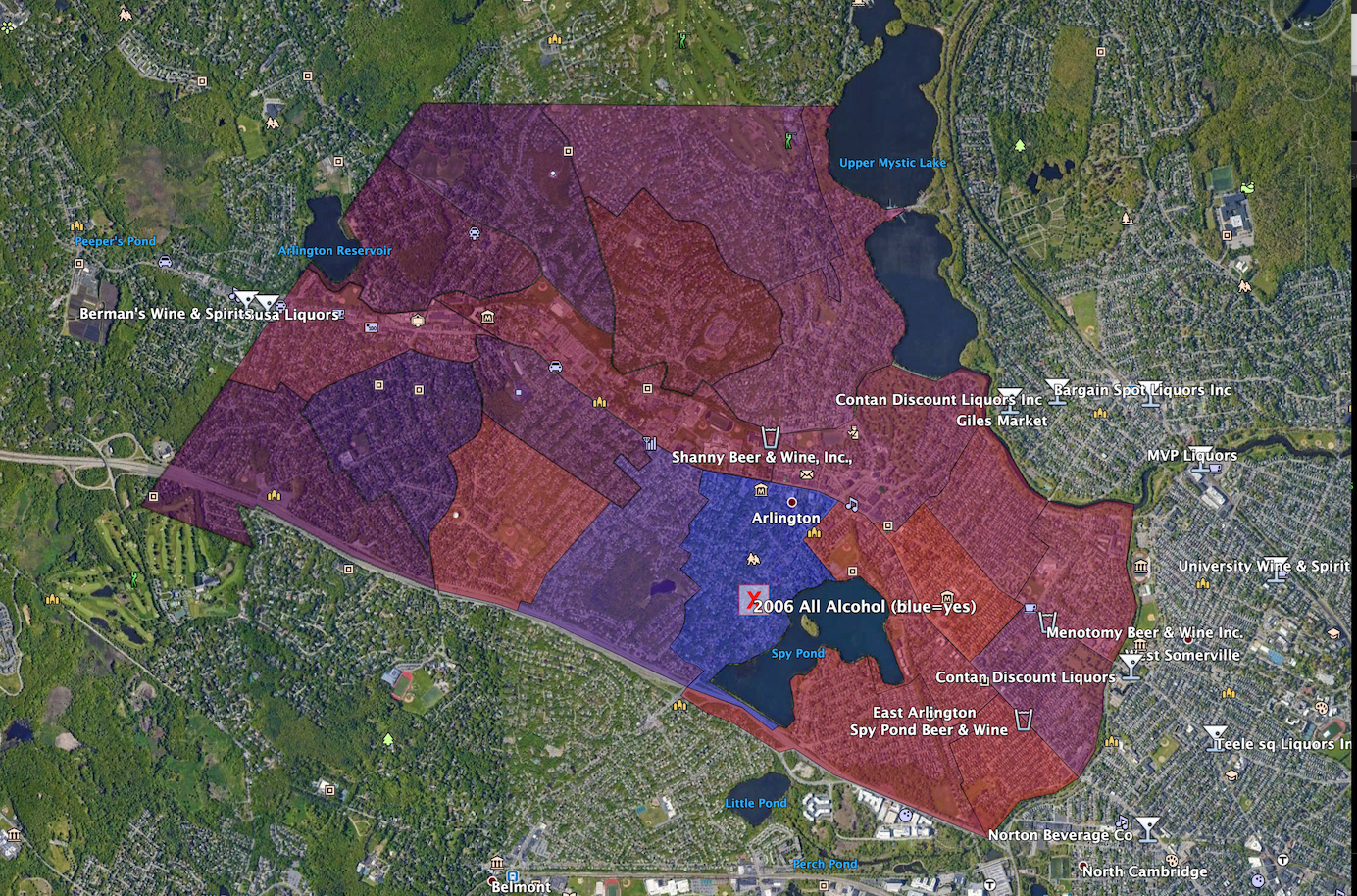
The precinct map generator was a project in the mid-2000's that allowed
citizens to easily upload town election data and display it on a
map. Unfortunately the Google Maps API has changed significantly in the
intervening years, and the map maker no longer works.
Fortunately, I decided to use KML as the internal data format for the
maps, so it is still possible to view archived maps using a KML
viewer. Here's a recreation of on the the maps in Google Earth, showing the
relationship between a precinct's support of all alcohol store licences and
that precincts' proximity to existing liquor stores in neighboring towns:
|